
 Continue with onX Maps
 Continue with Facebook


 Particularly Special Place


 Intermediate/Difficult
Intermediate/Difficult
Intermediate/Difficult
 Intermediate/Difficult
Land Manager: USFS - Pikes Peak Ranger District
 South Tarryall Peak
8.1 mi 13.1 km • 1,514' Up 461.5 m Up • 1,514' Down 461.55 m Down
 Bailey, CO
 Lake Park Lasso
13.5 mi 21.6 km • 3,259' Up 993.36 m Up • 3,252' Down 991.17 m Down
 Bailey, CO
 Dome Rock Loop Trail
10.8 mi 17.4 km • 1,590' Up 484.7 m Up • 1,583' Down 482.47 m Down
Cripple…, CO
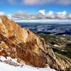
Pikes Peak Northwest Slopes
6.6 mi 10.6 km • 4,123' Up 1256.58 m Up • 27' Down 8.28 m Down
Cascade…, CO
Horsethief Falls
2.9 mi 4.6 km • 639' Up 194.77 m Up • 646' Down 196.89 m Down
Sentinel Point
6.9 mi 11.1 km • 2,737' Up 834.24 m Up • 2,728' Down 831.61 m Down


1 Comment