
 Continue with onX Maps
 Continue with Facebook


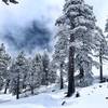
 Particularly Special Place


 Difficult
Difficult
Difficult
 Difficult
Land Manager: USFS - Angeles National Forest Office
 Icehouse to Cucamonga and Etiwanda Peaks
15.4 mi 24.8 km • 4,422' Up 1347.84 m Up • 4,424' Down 1348.57 m Down

 San Ant…, CA
 Timber Mountain
8.8 mi 14.1 km • 3,296' Up 1004.74 m Up • 3,296' Down 1004.63 m Down
San Ant…, CA
Three T's - Mt. Baldy
16.6 mi 26.7 km • 6,779' Up 2066.37 m Up • 5,627' Down 1715.11 m Down
San Ant…, CA
Cucamonga Peak via Icehouse Canyon
11.4 mi 18.3 km • 4,051' Up 1234.84 m Up • 4,055' Down 1235.91 m Down
San Ant…, CA
 Cooper Canyon Falls Out and Back
3.8 mi 6.2 km • 790' Up 240.74 m Up • 790' Down 240.73 m Down
Azusa, CA
Devil's Chair from Devil's Punchbowl Park
7.4 mi 12.0 km • 1,116' Up 340.22 m Up • 1,116' Down 340.09 m Down


0 Comments