Hiking Project Logo

The very beautiful, but more difficult loop of the Logan Trail.


Your Rating: Rating Rating Rating Rating Rating      Clear Rating
Your Difficulty:
Your Favorites: Add To-Do · Your List
Zoom in to see details
Map Key

9.8

Miles

15.7

KM

Loop

1,159' 353 m

High

777' 237 m

Low

1,476' 450 m

Up

1,490' 454 m

Down

6%

Avg Grade (3°)

41%

Max Grade (22°)

Dogs Leashed

Features Commonly Backpacked · Fall Colors · River/Creek · Spring · Wildlife

Family Friendly Can be done as a one night backpacking trip. We hike a lot, and we completed this hike with our seven and six year old and with our two year old on my back.

Overview

A rugged loop on some of the more difficult terrain to be found at Tar Hollow State Park.

Need to Know

Don't pack a ton of water on this one; bring some, but there are plenty of places to filter along the western half of the trail. Water is also available on the northeastern third of the trail as it passed through Tar Hollow State Park campground. The only really dry portions of the trail are on the southeast leg of the loop.

If you like PUDs (pointless ups and downs) you'll love the eastern half of the loop, while the western half is all about climbing up to ridgeline or descending to hike next to the stream.

Description

This hike encompasses the northern loop of the Logan Trail. The jagged figure-8 Logan Trail is marked with red blazes throughout—the blazes are not standard 2x4 in. rectangular blazes following AT and BT blaze convention, but instead are red dots or arrows where the trail quickly turns.

At Brush Ridge Fire Tower the North Loop, South Loop, and Buckeye Trail meet, The fire tower is one of three trailheads. Backpackers can camp at the fire tower but a reservation at the Ohio Department of Natural Resources, Division of Forestry is required. The fire tower sites have pit toilets and tent pads downhill from the privy area. There is no water at these sites. The second trailhead (for multi-day backpackers) can be found below the Pine Lake Dam, and the third trailhead, for campers at the Tar Hollow State Park Campground, is located directly behind campsite #53 on Logan Hollow Road.

To follow this as mapped, start from the parking area off Tar Hallow Rd. and follow the trail north up past the Tar Hollow State Park campground. Continue on the trail as it winds through Logan Hollow along the stream bed before climbing out of the hollow and emerging on North Ridge Road.

While not well-marked, the trail continues slightly to your left on the other side of the road, expect to pass through about 100 yards of regrowth forest before the trail dumps you out on a bulldozer track running along the ridge. The trail continues to the left. From this point forward along the western half of the loop, the trail is no longer singletrack but has been bulldozed.

The trail will dive to the left down a hollow, following a stream to the right while slowly working south along the side of the hill. After crossing Tar Hollow Road and then the stream next to it (this part was not well marked) take the trail which bears slightly right and uphill, and prepare yourself for an epic climb followed by some ridge hiking and an epic descent. Unfortunately, this descent is a mess. It heads along a highly eroded dozer track straight downhill, so plan accordingly.

Once at the bottom enjoy hiking alongside, through, and crossing (multiple times) a stream (great time to filter water) before climbing back up out of the hollow to the fire tower and better yet a return to singletrack trail. From this point forward the trail is pretty easy to follow. Continue east on Logan Trail until it drops you back at the parking lot.

Flora & Fauna

Tar Hollow is one of the few places in Ohio where you can still find Timber Rattlesnakes. Also, I recommend long pants, as stinging nettles were out in force along stream beds. Unfortunately, the ever preset compliment of ticks were also out in force.

Contacts

Shared By:

Jesse Dailey

Trail Ratings

  4.2 from 13 votes

#2471

Overall
  4.2 from 13 votes
5 Star
38%
4 Star
54%
3 Star
0%
2 Star
8%
1 Star
0%
Recommended Route Rankings

#25

in Ohio

#2,471

Overall
9 Views Last Month
2,594 Since May 21, 2018
Difficult Difficult

0%
0%
9%
9%
82%
0%

Photos

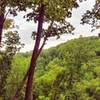
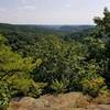
Looking south from the ridge above Pine Lake.
May 21, 2018 near Kingston, OH
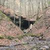
Creek running along the southwest leg of the North Loop
May 21, 2018 near Kingston, OH
Brush Ridge Fire Tower
Jan 15, 2019 near Chillic…, OH
loading

Weather


Current Trail Conditions

Unknown
Add Your Check-In

Check-Ins

Apr 24, 2022
Zach Trosch
It says 9 miles or so, but I tracked 13.2 on GPS. 13.2mi — 7h 30m
Mar 5, 2022
Alex Colosimo
Surprisingly hard, go back during growing season to see puttyroot and other wildflowers 9.5mi — 2h 56m
Dec 6, 2020
Jeanne Graessle
The fire tower was blocked off and steps were removed. Trail is well maintained and delightful! 9.6mi — 3h 45m
Oct 3, 2020
Greg Steinmetz
Good trail. Mostly singletrack. Overgrown in areas. Hills are very steep. 10.3mi — 4h 26m
Feb 3, 2019
Chase Smith
9.3mi
Dec 30, 2018
Chase Smith
Trail run. Ran roads instead of running N Ridge Road to Tar Hollow Rd trail section. 9mi
Nov 11, 2018
Michael Chavez
9.8mi
May 19, 2018
Jesse Dailey
Trail needs some TLC -- poorly blazed post leaf-out, lots of down trees, some washouts, western side bulldozed and eroded on steep grades. 9.7mi — 6h 37m
Welcome

Join the Community

Create your FREE account today!
Already have an account? Login to close this notice.

Get Started