
 Continue with onX Maps
 Continue with Facebook


 Particularly Special Place


 Intermediate
Intermediate
Intermediate
 Intermediate
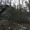
Land Manager: North Carolina State Parks - Pilot Mountain State Park
 Pilot Mountain Loop
5.7 mi 9.1 km • 643' Up 195.98 m Up • 647' Down 197.35 m Down

 Pilot M…, NC
Pilot Mountain Loop
Pilot M…, NC
Pilot Mountain Loop
10.8 mi 17.4 km • 1,938' Up 590.84 m Up • 1,938' Down 590.82 m Down
Pilot M…, NC
Hanging Rock Trail
2.7 mi 4.3 km • 443' Up 135.15 m Up • 440' Down 134.24 m Down
Danbury, NC
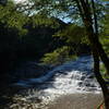
 Isaacs Trailhead to Grassy Creek/Carter Falls
6.8 mi 10.9 km • 538' Up 164.04 m Up • 538' Down 164.06 m Down
Blue Ridge Music Center Loop
3.8 mi 6.2 km • 540' Up 164.68 m Up • 542' Down 165.1 m Down


0 Comments