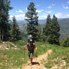
Land Manager: USFS - White River National Forest Office
 Snowmass - Willow Lake Loop
22.3 mi 35.9 km • 5,436' Up 1657.01 m Up • 5,456' Down 1662.91 m Down


 Snowmas…, CO
 Four Pass Loop
27.1 mi 43.6 km • 7,265' Up 2214.42 m Up • 7,266' Down 2214.53 m Down


 Snowmas…, CO
 Bellyache Lollipop
6.7 mi 10.8 km • 1,503' Up 458.15 m Up • 1,503' Down 458.24 m Down


 Edwards, CO
 Ute Trail to Ajax Sundeck
3.1 mi 5.0 km • 3,211' Up 978.64 m Up • 0' Down 0 m Down


 Aspen, CO
 Chapman Lake
7.1 mi 11.4 km • 1,252' Up 381.66 m Up • 1,251' Down 381.19 m Down


 Aspen, CO
 Twin Meadows to Margy's Hut
4.6 mi 7.4 km • 1,978' Up 602.86 m Up • 117' Down 35.8 m Down


 Aspen, CO


0 Comments