
 Continue with onX Maps
 Continue with Facebook


 Particularly Special Place


 Intermediate
Intermediate
Intermediate
 Intermediate
Land Manager: East Bay Regional Park District (CA)
 Las Trampas North Loop
9.6 mi 15.4 km • 2,273' Up 692.77 m Up • 2,300' Down 701.16 m Down

 EBRPD Trails Challenge 2017: Anthony Chabot
8.5 mi 13.6 km • 1,085' Up 330.68 m Up • 1,093' Down 333.08 m Down
 Ashland, CA
Leona Canyon
Ashland, CA
Leona Canyon
5.9 mi 9.6 km • 1,257' Up 383.18 m Up • 1,262' Down 384.61 m Down
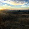
 Juniper to Summit Loop
6.6 mi 10.6 km • 1,737' Up 529.47 m Up • 1,727' Down 526.27 m Down
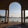
 Lake Merritt Loop
3.4 mi 5.5 km • 45' Up 13.86 m Up • 45' Down 13.85 m Down
Ohlone-Crystyl Ranch Loop
5.5 mi 8.9 km • 734' Up 223.87 m Up • 747' Down 227.67 m Down


0 Comments