
 Continue with onX Maps
 Continue with Facebook


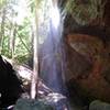
 Particularly Special Place


 Intermediate/Difficult
Intermediate/Difficult
Intermediate/Difficult
 Intermediate/Difficult
Land Manager: Kentucky State Parks - Cumberland Falls State Park
 Sheltowee Trace NRT - Section 24 Central to Suspension Bridge
3.3 mi 5.4 km • 391' Up 119.23 m Up • 393' Down 119.65 m Down

 Sheltowee Trace NRT - Section 24 South
2.7 mi 4.3 km • 339' Up 103.39 m Up • 339' Down 103.33 m Down
Sheltowee Trace NRT: Section 24 North
3.3 mi 5.3 km • 453' Up 138.06 m Up • 483' Down 147.36 m Down
 Natural Bridge Loop
1.2 mi 2.0 km • 200' Up 60.86 m Up • 198' Down 60.49 m Down
Slave Falls Loop Trail
3.2 mi 5.1 km • 378' Up 115.15 m Up • 368' Down 112.19 m Down
 John Muir Trail: Big South Fork NRA
49.9 mi 80.3 km • 6,267' Up 1910.14 m Up • 5,972' Down 1820.33 m Down


0 Comments