
 Continue with onX Maps
 Continue with Facebook


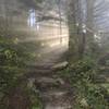
 Particularly Special Place


 Difficult
Difficult
Difficult
 Difficult
Land Manager: Buncombe County, NC
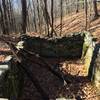
 Rattlesnake Lodge Loop
4.0 mi 6.5 km • 847' Up 258.17 m Up • 847' Down 258.18 m Down

 Mount Mitchell
11.7 mi 18.8 km • 3,651' Up 1112.72 m Up • 3,650' Down 1112.62 m Down
 Black M…, NC
Mount Mitchell - Black Mountain Crest Trail #179
Black M…, NC
Mount Mitchell - Black Mountain Crest Trail #179
12.1 mi 19.5 km • 5,010' Up 1526.98 m Up • 1,498' Down 456.71 m Down
Burnsville, NC
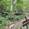
 Buffalo Creek Park
4.1 mi 6.6 km • 593' Up 180.84 m Up • 593' Down 180.86 m Down
Lake Lure, NC
Bailey Mountain Preserve Loop (Mars Hill, NC)
5.1 mi 8.3 km • 1,461' Up 445.29 m Up • 1,459' Down 444.72 m Down
Bald Mountain Creek Preserve Outer Loop
7.3 mi 11.8 km • 1,875' Up 571.35 m Up • 1,878' Down 572.36 m Down


 All Clear


0 Comments