
 Continue with onX Maps
 Continue with Facebook


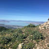
 Particularly Special Place


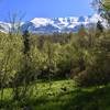
 Intermediate/Difficult
Intermediate/Difficult
Intermediate/Difficult
 Intermediate/Difficult
Land Manager: USFS - Uinta, Wasatch & Cache National Forests Office
 Route to the Y
2.2 mi 3.5 km • 981' Up 299.01 m Up • 980' Down 298.7 m Down

 Big Baldy via Dry Canyon
7.5 mi 12.1 km • 3,331' Up 1015.35 m Up • 3,322' Down 1012.59 m Down
 Lindon, UT
Grove Creek/Battle Creek Loop
Lindon, UT
Grove Creek/Battle Creek Loop
8.2 mi 13.1 km • 2,556' Up 779.12 m Up • 2,563' Down 781.07 m Down
Pleasan…, UT
Horsetail Falls
4.2 mi 6.7 km • 1,495' Up 455.67 m Up • 1,494' Down 455.41 m Down
Alpine, UT
 Cecret Lake Interpretive Trail
1.7 mi 2.7 km • 455' Up 138.78 m Up • 455' Down 138.67 m Down
Alta, UT
Quick Bell Canyon Loop
2.2 mi 3.5 km • 426' Up 129.95 m Up • 445' Down 135.6 m Down
Granite, UT


0 Comments