Hiking Project Logo

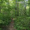
A wooded trail running along the foot of the Birkhead Mountains.


Your Rating: Rating Rating Rating Rating Rating      Clear Rating
Your Difficulty:
Your Favorites: Add To-Do · Your List
Zoom in to see details
Map Key

1.4

Miles

2.3

KM

Point to Point

587' 179 m

High

494' 151 m

Low

173' 53 m

Up

147' 45 m

Down

4%

Avg Grade (2°)

11%

Max Grade (6°)

Dogs Unknown

Features Birding · Fall Colors · River/Creek · Wildflowers · Wildlife

Family Friendly Gently rolling, low hills and a couple of creek crossings make this an easier trail for children to enjoy.

Description

Hannah's Creek Trail starts at a junction with Robbins Branch Trail in the southwest part of the BIrkhead Mountains Wilderness. It soon crosses Robbins Branch and then roughly parallels its namesake creek. This trail is an easy outing, without any long or steep hills.

Along the way visitors can spot the tumbled chimneys of old homesteads. Camp #4, one of the backcountry campsites established by the Boy Scouts who built the trails in the 1970's, is located not far off the trail.

The trail ends at a junction with the Birkhead Mountain Trail, not far from the Bingham Graveyard and Camp #6.

Thanks to Don Childrey for sharing this description. Learn more about the 200+ miles of trail winding through this region of rivers, lakes, and ancient mountains in the heart of North Carolina's Piedmont - check out the Uwharrie Lakes Region Trail Guide.

Contacts

Shared By:

Don Childrey

Trail Ratings

  3.5 from 4 votes

#24395

Overall
  3.5 from 4 votes
5 Star
25%
4 Star
25%
3 Star
25%
2 Star
25%
1 Star
0%
Trail Rankings

#974

in North Carolina

#24,395

Overall
3 Views Last Month
1,279 Since May 17, 2016
Easy/Intermediate Easy/Intermediate

50%
25%
25%
0%
0%
0%

Photos

Creek crossing on the Camp Four Trail
Feb 11, 2018 near Denton, NC
Half a billion year old Greenstone boulders
Feb 12, 2018 near Denton, NC

0 Comments

Weather


Current Trail Conditions

Unknown
Add Your Check-In

Check-Ins

Mar 7, 2021
Sean Farrell
Short day hike to the small campsite near the end. Water was fairly high and there was a good deal of mud but easily avoidable. Nice cool day. 2.8mi — 2h 00m
Mar 5, 2019
Taylor Young
Mar 18, 2017
Gene Staley
3.7mi
Welcome

Join the Community

Create your FREE account today!
Already have an account? Login to close this notice.

Get Started