
 Continue with onX Maps
 Continue with Facebook


 Particularly Special Place


 Intermediate
Intermediate
Intermediate
 Intermediate
Land Manager: Florida State Parks - Little Manatee River State Park
 Gopher Trail and Persimmon Loop
3.2 mi 5.1 km • 43' Up 13.2 m Up • 66' Down 20.25 m Down

 Samoset, FL
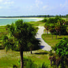
 Barrier-Free Nature Trail
0.4 mi 0.7 km • 3' Up 0.83 m Up • 3' Down 0.8 m Down
Weedon Island Preserve Route
4.6 mi 7.4 km • 22' Up 6.77 m Up • 21' Down 6.44 m Down
Limpkin Loop
1.9 mi 3.0 km • 20' Up 6.17 m Up • 20' Down 6.1 m Down
Temple…, FL


0 Comments