
 Continue with onX Maps
 Continue with Facebook


 Particularly Special Place


 Difficult
Difficult
Difficult
 Difficult
 Cascade Falls Loop
4.0 mi 6.4 km • 798' Up 243.33 m Up • 797' Down 242.93 m Down

 Pembroke, VA
 Angel's Rest Out and Back
5.3 mi 8.5 km • 1,639' Up 499.54 m Up • 1,638' Down 499.3 m Down
Pearisburg, VA
Kelly Knob Out and Back
7.9 mi 12.7 km • 1,752' Up 534.1 m Up • 1,752' Down 533.93 m Down
Blacksburg, VA
Mill Mountain Park Loop
7.3 mi 11.7 km • 1,293' Up 393.98 m Up • 1,291' Down 393.55 m Down
Roanoke, VA
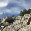
Devils Marbleyard Out and Back
2.8 mi 4.5 km • 778' Up 237.17 m Up • 778' Down 237.09 m Down
Glasgow, VA
Rocky Row
7.5 mi 12.0 km • 1,873' Up 570.83 m Up • 1,873' Down 570.8 m Down


0 Comments