
 Continue with onX Maps
 Continue with Facebook


 Particularly Special Place


 Intermediate
Intermediate
Intermediate
 Intermediate
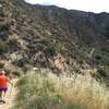
 Hogfarm Loop
5.0 mi 8.1 km • 952' Up 290.14 m Up • 870' Down 265.28 m Down
 Trail Canyon to Trail Canyon Falls and Tom Lucas Campground
9.5 mi 15.3 km • 2,019' Up 615.51 m Up • 2,019' Down 615.25 m Down
Cooks Canyon Lookout
1.4 mi 2.3 km • 310' Up 94.6 m Up • 310' Down 94.6 m Down
 Rice Canyon and Mission Point Out and Back
11.4 mi 18.3 km • 2,007' Up 611.76 m Up • 2,006' Down 611.56 m Down
Santa C…, CA
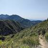
Mt Lukens Road Saddle Out-and-Back
5.2 mi 8.4 km • 1,182' Up 360.31 m Up • 1,181' Down 359.91 m Down
 Cahuenga Peak
3.0 mi 4.8 km • 924' Up 281.76 m Up • 925' Down 281.93 m Down


0 Comments