
 Continue with onX Maps
 Continue with Facebook


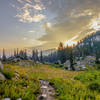
 Particularly Special Place


 Difficult
Difficult
Difficult
 Difficult
Land Manager: USFS - Uinta, Wasatch & Cache National Forests Office
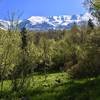
 Stewart Cascades Trail #056
3.6 mi 5.9 km • 680' Up 207.3 m Up • 680' Down 207.27 m Down

 Cedar H…, UT
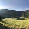
 Grove Creek/Battle Creek Loop
8.2 mi 13.1 km • 2,556' Up 779.12 m Up • 2,563' Down 781.07 m Down
Pleasan…, UT
Cecret Lake Interpretive Trail
1.7 mi 2.7 km • 455' Up 138.78 m Up • 455' Down 138.67 m Down
Alta, UT
Alta-Brighton Loop
8.6 mi 13.8 km • 2,297' Up 700.24 m Up • 2,319' Down 706.93 m Down
Alta, UT
Donut Falls Trail
1.5 mi 2.4 km • 417' Up 127.15 m Up • 416' Down 126.94 m Down
Cottonw…, UT
Dog Lake and Desolation Lake
8.6 mi 13.8 km • 2,098' Up 639.5 m Up • 2,112' Down 643.72 m Down


1 Comment