
 Continue with onX Maps
 Continue with Facebook


 Particularly Special Place


 Intermediate
Intermediate
Intermediate
 Intermediate
Land Manager: USFS - Pisgah National Forest, Pisgah Ranger District
 Sam Knob Loop
9.8 mi 15.7 km • 1,393' Up 424.63 m Up • 1,402' Down 427.37 m Down

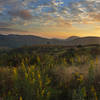
 Brevard, NC
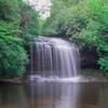
 Bearpen Gap Waterfall
3.2 mi 5.2 km • 626' Up 190.93 m Up • 627' Down 191.04 m Down
 Hap Nin Half-ish Marathon (Shining Rock Loop)
13.3 mi 21.4 km • 3,106' Up 946.86 m Up • 3,101' Down 945.1 m Down
Coontree Loop
3.5 mi 5.7 km • 1,007' Up 306.94 m Up • 1,007' Down 307.06 m Down
Big Green Mountain — Little Green Mountain Loop
8.5 mi 13.6 km • 1,173' Up 357.57 m Up • 1,172' Down 357.09 m Down
Brevard, NC
Mills River Loop
3.6 mi 5.8 km • 315' Up 96.13 m Up • 332' Down 101.06 m Down


0 Comments