
 Continue with onX Maps
 Continue with Facebook


 Particularly Special Place


 Intermediate/Difficult
Intermediate/Difficult
Intermediate/Difficult
 Intermediate/Difficult
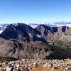
 Belford and Oxford
10.9 mi 17.5 km • 5,670' Up 1728.35 m Up • 5,670' Down 1728.32 m Down

 Leadvil…, CO
MOB Mission: Missouri-Oxford-Belford
Leadvil…, CO
MOB Mission: Missouri-Oxford-Belford
15.4 mi 24.8 km • 7,066' Up 2153.67 m Up • 7,068' Down 2154.32 m Down
Leadvil…, CO
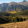
 Huron Peak
6.4 mi 10.2 km • 3,301' Up 1006.19 m Up • 3,301' Down 1006.03 m Down
Buena V…, CO
Black Cloud Trail to Elbert Summit
10.9 mi 17.5 km • 5,023' Up 1531.13 m Up • 5,023' Down 1530.98 m Down
Leadvil…, CO
Mt. Massive via CDT
13.4 mi 21.5 km • 4,456' Up 1358.07 m Up • 4,455' Down 1357.95 m Down
Leadvil…, CO
Poplar Gulch Trail
12.6 mi 20.3 km • 4,193' Up 1278.06 m Up • 4,193' Down 1278.12 m Down
St. Elmo, CO


0 Comments