
 Continue with onX Maps
 Sign in with Facebook


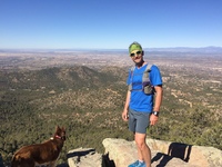
 Particularly Special Place


 Intermediate
Intermediate
Intermediate
 Intermediate
Land Manager: USFS - Santa Fe National Forest Office
 Dale Ball to Big T Campground
24.0 mi 38.7 km • 4,380' Up 1335.13 m Up • 4,380' Down 1335.05 m Down
 Picacho Peak from Cerro Gordo TH
3.4 mi 5.5 km • 1,144' Up 348.71 m Up • 1,143' Down 348.43 m Down
 Santa Fe, NM
Atalaya + Picacho Loop
Santa Fe, NM
Atalaya + Picacho Loop
9.6 mi 15.4 km • 2,346' Up 714.94 m Up • 2,351' Down 716.5 m Down
 Arroyo Hondo
2.8 mi 4.6 km • 435' Up 132.48 m Up • 434' Down 132.15 m Down
 Los Alamos County Low Point to High Point
38.0 mi 61.1 km • 9,338' Up 2846.1 m Up • 7,914' Down 2412.07 m Down
West Fork Rio Santa Barbara
20.4 mi 32.9 km • 3,183' Up 970.23 m Up • 3,183' Down 970.1 m Down


3 Comments