
 Continue with onX Maps
 Continue with Facebook


 Particularly Special Place


 Difficult
Difficult
Difficult
 Difficult
Land Manager: National Park Service - Rocky Mountain National Park
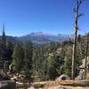
 Deer Mountain
6.3 mi 10.1 km • 1,325' Up 403.97 m Up • 1,325' Down 403.92 m Down

 Estes Park, CO
 Deer Mountain Loop
10.5 mi 16.9 km • 1,698' Up 517.54 m Up • 1,698' Down 517.52 m Down
Estes Park, CO
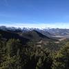
Lumpy Ridge Loop
10.7 mi 17.2 km • 2,361' Up 719.53 m Up • 2,387' Down 727.44 m Down
Estes Park, CO
 Lumpy Ridge Short Loop
1.6 mi 2.6 km • 400' Up 121.82 m Up • 378' Down 115.35 m Down
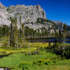
Bear Lake TH to Fern Lake TH
8.5 mi 13.6 km • 1,180' Up 359.71 m Up • 2,524' Down 769.27 m Down
Estes Park, CO
Pole Hill Road
6.7 mi 10.8 km • 1,189' Up 362.32 m Up • 1,192' Down 363.38 m Down
Estes Park, CO


0 Comments