Dogs Unknown

Features
Birding · Historical Significance · Wildflowers
Need to Know
Access to the trail is open. Since this is not a circuit, a vehicle drop is recommended at the start, and a pickup at the end. There are also local jeep-taxis that ply along the state highway that can drop one off at the trailhead at Suwakholi, and Thatyur being a major township, the same will be available back to Mussoorie.
There are no cafes or restrooms along the way, and the trail skirts isolated hamlets. Following Leave No Trace principles, particularly for waste management is highly recommended.
Thatyur is a busy town with narrow roads, hence parking here although free, is in short supply. There are plenty of eateries here, where one can get a simple meal of local food.
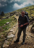
Description
This trail was once used by potato farmers to transport their crop from Suwakholi to Thatyur, hence the name.
As such, it is an easy trail to hike, somewhat disused in its entirety, but used in sections to connect hamlets along the way. The trail closely follows the route of the metalled road that connects Suwakholi to Thayur, for some distance, and it is possible to access this at some places. However, the trail later follows a direct route down into the Aglar Valley, whereas the road takes a much more circuitous route.
The trail is on a gentle incline with very few steeper sections. Some parts of the trail are a little narrow and tricky due to landslides, but the surface is otherwise easily negotiable. There are a 3-4 waterpoints along the way, mostly concrete water storage tanks, and a couple of springs. The last 1 km of the trail follows an irrigation channel down into Thatyur. However, the water from all these sources will need to be purified.
The trail follows the northern aspect of the Mussoorie ridge, so the sun doesn't really gain strength till later in the day. Starting earlier in the morning and completing the trail before the afternoon is recommended in the summer months, as the lower elevation Aglar Valley can become extremely hot during the latter half of the day.
There are pretty views of the Nagtibba Ridge, along with the Aglar Valley, from some sections of the trail.
Flora & Fauna
The start of the trail, being at a higher elevation passes through straggly Oak-Rhododendron mixed forest with Kaphal (Myristica nagi), wild raspberry (Rubus sp.), wild rose, stinging nettle (Urtica sp.) and Berberis sp. shrubs lining the path. The majority of the trail passes through open Chir (Pinus roxburghii) stands, some of which have visible tapping marks for commercial resin collection. There is scant canopy cover in this section.
The latter part of the trail is through low-elevation. scrubby vegetation with few tall trees, and mostly cultivation with potato and wheat fields.
Birding is good at the start of the trail, but tapers away as one descends into the valley and the vegetation becomes sparser. There are few wild animals one is likely to meet on the trail, but domestic cows and goats do use the trail. One can come across evidence of Leopard, Yellow-throated Marten and Jackal along the way, but these are likely seldom encountered.
Shared By:
Suniti Bhushan Datta

 Continue with onX Maps
 Sign in with Facebook


 Particularly Special Place


 Intermediate


0 Comments