
 Continue with onX Maps
 Continue with Facebook


 Particularly Special Place


 Intermediate/Difficult
Intermediate/Difficult
Intermediate/Difficult
 Intermediate/Difficult
 Lost Man Lake
5.4 mi 8.7 km • 1,525' Up 464.97 m Up • 1,525' Down 464.95 m Down

 Aspen, CO
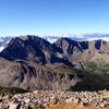
 Grizzly Peak and Garfield Peak
7.3 mi 11.7 km • 2,910' Up 887.04 m Up • 2,913' Down 887.93 m Down
La Plata Peak Out and Back
9.4 mi 15.1 km • 4,276' Up 1303.2 m Up • 4,276' Down 1303.18 m Down
Leadvil…, CO
 Big Willis Gulch Trail
11.2 mi 18.1 km • 3,016' Up 919.34 m Up • 3,016' Down 919.3 m Down
Lake Ann Out-and-Back
11.2 mi 18.0 km • 1,715' Up 522.76 m Up • 1,715' Down 522.61 m Down
St. Elmo, CO
Huron Peak
6.4 mi 10.2 km • 3,301' Up 1006.19 m Up • 3,301' Down 1006.03 m Down
Buena V…, CO


0 Comments