Hiking Project Logo

Trail along Akamina Creek that leads to forest service road(s) and a climbers' route up Festubert Mountain.


Your Rating: Rating Rating Rating Rating Rating      Clear Rating
Your Difficulty:
Your Favorites: Add To-Do · Your List
Zoom in to see details
Map Key

5.3

Miles

8.5

KM

Point to Point

5,691' 1,735 m

High

4,911' 1,497 m

Low

46' 14 m

Up

826' 252 m

Down

3%

Avg Grade (2°)

14%

Max Grade (8°)

Dogs Leashed

Features River/Creek · Views · Wildflowers · Wildlife

Description

Festubert Mountain Route is a continuation of Akamina Pass Trail.

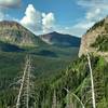
Descending gradually, Festubert Mountain Route follows Akamina Creek downstream through the 2017 Kenow Fire burn area. With the tall trees stripped of foliage by the fire, there are nice views of the surrounding rugged mountains through the forest of burnt tree trunks. The forest floor is covered with dense, bright green, new low vegetation, and wildflowers.

Akamina Creek can be seen and heard nearby in its valley bottom, to the left/southwest. The trail crosses several side streams that empty into Akamina Creek. To the right/northeast a steep sided ridge rises to the Great Divide, very dramatic scenery.

Significant trail junctions along Festubert Mountain Route include the West Boundary Trail junction at the 0.9 mile mark, and a climbers' route up Festubert Mountain at the 4.1 mile mark. This trail description ends after 5.3 miles where the "trail" continues on as a rough road.

Flora & Fauna

Thick new, bright green low vegetation that is part of the natural recovery cycle from a wildfire, in this case the 2017 Kenow Wildfire. Wildflowers. Bears live here.

Contacts

Shared By:

Joan Pendleton

Trail Ratings

  3.0 from 1 vote

#38959

Overall
  3.0 from 1 vote
5 Star
0%
4 Star
0%
3 Star
100%
2 Star
0%
1 Star
0%
Trail Rankings

#180

in Alberta

#38,959

Overall
1 Views Last Month
5 Since Jul 25, 2022
Intermediate Intermediate

0%
0%
100%
0%
0%
0%

Photos

Akamina Creek runs through the valley below.  If it wasn't for the dense vegetation being burned by the 2017 Kenow Fire, the creek would only be heard, not seen.
Jul 25, 2022 near Pincher…, AB
The trail runs through the regenerating 2017 Kenow Fire burn area with great views of the rugged mountains.
Jul 25, 2022 near Pincher…, AB
Snowy peaks of Akamina Ridge are seen through the forest of the regenerating 2017 Kenow Fire burn area.  Looking closely one can see Akamina Creek nearby in the valley below.
Jul 25, 2022 near Pincher…, AB

0 Comments

Current Trail Conditions

Unknown
Add Your Check-In

Check-Ins

Jun 28, 2022
Joan Pendleton
Welcome

Join the Community

Create your FREE account today!
Already have an account? Login to close this notice.

Get Started