Hiking Project Logo

Starts with high desert wildflowers and climbs along Hilton Creek to the large alpine Hilton Lakes.


Your Rating: Rating Rating Rating Rating Rating      Clear Rating
Your Difficulty:
Your Favorites: Add To-Do · Your List
Zoom in to see details
Map Key

6.7

Miles

10.8

KM

Point to Point

9,886' 3,013 m

High

7,241' 2,207 m

Low

2,657' 810 m

Up

11' 3 m

Down

8%

Avg Grade (4°)

21%

Max Grade (12°)

Dogs Leashed

Features Fishing · Lake · River/Creek · Swimming · Views · Wildflowers · Wildlife

No campfires are allowed. Wilderness permits are required for all overnight stays. Reservations can be made at recreation.gov and some walk-in permits can be obtained from Inyo National Forest visitor centers. This trail is less used than the Hilton Lakes Trail.

Description

To reach the trailhead, turn off US 395, where the sign says "Crowley Lake" on one line, with "Hilton Creek" on the next line. Go through the little village and turn right on Crowley Lake Drive. After about 3/4th mile, turn left on Hilton Creek Hostel Rd. The parking lot for the trailhead is about 1/2 mile up the road. In spite of the name, there is no hostel. Also, there is no longer a pack station there.

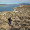
The trail starts in the high desert at 7300 feet. There is no easy access to the creek and no shade for the first 2 1/2 miles. While the trail is only moderately steep as it switchbacks up the mountain, this part can be very hot in the afternoon. There is a very prominent trail-of-use that cuts all the switchbacks and goes straight up the mountain. Just beyond the switchbacks, the trail joins the McGee Creek to Hilton Creek 4-wheel driver road (vehicles no longer allowed), and a little farther from there, it begins to closely follow the creek. Up to this point, there are beautiful high desert flowers and great views back across Crowley Lake to the surrounding Sierra and White Mountains.

At about 3.5 miles, the trail crosses Hilton Creek and continues to climb though high desert scrub. Finally, at about 4.5 miles and 9400 feet, we reach the green meadows and lodge pole and white bark pines of the High Sierra. The eastern shore of Davis Lake, the largest of the Hilton Lakes is at about 5.7 miles. There is good camping along this shore. At about 6.0 miles, the trail moves away from Davis Lake and climbs slightly past meadows to reach the junction with the Davis Lake Spur and Hilton Lakes Trail near Hilton Lake 2.

From here, you can either explore the other Hilton Lakes and return the way you came, or if you can leave a second car at the Hilton Lakes trailhead near Rock Creek, you can make a great hike from one side to the other and exploring all the lakes in between.

Contacts

Shared By:

Lee Watts

Trail Ratings

  4.0 from 1 vote

#2

in Crowley Lake

#15698

Overall
  4.0 from 1 vote
5 Star
0%
4 Star
100%
3 Star
0%
2 Star
0%
1 Star
0%
Trail Rankings

#2

in Crowley Lake

#1,647

in California

#15,698

Overall
2 Views Last Month
265 Since Jun 18, 2021
Intermediate/Difficult Intermediate/Difficult

0%
0%
0%
100%
0%
0%

Photos

North end of Davis Lake. It is shallow and in less of an alpine setting, but fishing is great and the water is warmer than the other lakes.
Jun 18, 2021 near Mammoth…, CA

0 Comments

Weather


Current Trail Conditions

Unknown
Add Your Check-In

Check-Ins

none
Welcome

Join the Community

Create your FREE account today!
Already have an account? Login to close this notice.

Get Started