Use onX Backcountry to explore the terrain in 3D, view recent satellite imagery, and more.
Now available in onX Backcountry Mobile apps!
For more information see this post.
Permits and bear canisters are required for overnight stays in the King Range Wilderness. Permits can be obtained at recreation.gov.
Description
This secondary route for Lightning Trail starts at a signed junction and climbs easily under the trees before dropping to the creek. Multiple camp sites line the trail for about a quarter mile making up Maple Camp. Water can usually be found coming to the surface near the uppermost camp site and, when flow is low, vanishing again around the lowest camp sites.
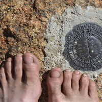
The trail crosses the creek near the upper camp site and climbs more steeply to chaparral at the ridge. A little more climbing brings it to the King Crest Trail (South: King Peak to Saddle Mountain Trailhead). Turn right to complete the climb to the peak.
We use cookies to improve your browsing experience, to show you
personalized content, and for statistical purposes. By continuing
to navigate our website, you accept our use of cookies. Read our
Privacy Policy to learn more.

 Continue with onX Maps
 Continue with Facebook


 Particularly Special Place


 Intermediate/Difficult


0 Comments