Hiking Project Logo

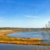
A figure-eight loop hike with views across the Patuxent Riverway and marshland and quiet sections through inner woodland.


Your Rating: Rating Rating Rating Rating Rating      Clear Rating
Your Difficulty:
Your Favorites: Add To-Do · Your List
Zoom in to see details
Map Key

3.4

Miles

5.4

KM

Loop

66' 20 m

High

6' 2 m

Low

79' 24 m

Up

78' 24 m

Down

1%

Avg Grade (1°)

4%

Max Grade (2°)

Dogs Leashed

Features Birding · River/Creek · Views · Wildlife

Family Friendly Flat and wide trails on a mix of dirt and pavement with viewpoints across the river to spot birds and wildlife.

Ground are open sunrise to sunset. Visitor Center open on weekends from 10 am - 4 pm.

Overview

From the Visitor Center, this hike heads east for a two-mile loop that visits some of the viewpoints across the river with opportunities to spot osprey and their nests. This section overlaps with the Critical Area Driving Tour (CADT) route on wide road, which can be nice for large groups or individuals who are more confident on flat ground.

That said, the second half of this hike heads to the southwest corner of the sanctuary onto the easy Paw Paw Trail for a sample of the blazed hiking trails available to explore further, such as the Poplar Springs trail and Mounds Trail.

As all trails in the sanctuary can be traveled on foot in either direction, this hike can be done in reverse or adapted to accommodate groups of varying abilities and/or ages.

Need to Know

CADT is open daily to driving, hiking, horseback riding, and biking. Beware of ticks. No hunting.

Description

From the Visitor Center parking head east toward Merkle Pond and the orange-blazed CADT. Turn right (south) at the first intersection to loop past access for the white-blazed Lookout Creek Trail toward the Catfish Pond Trail, boardwalk viewpoint and osprey nest area.

Head back to the Visitor Center along the CADT road to the north of Windmill Pond, this time heading west from the parking area toward the Paw Paw Trail. This easy trail loops around Stump Pond, where visitors can fish or enjoy a picnic.

From either end of the Paw Paw Trail, there is access to the Poplar Springs trail to the north and Mounds Trail to the southeast to extend your hike.

Flora & Fauna

Deer, beavers, osprey, songbirds, Canada geese.

History & Background

Named after Edgar Merle (1900-1984), who spent the majority of his life working for the protection of wildlife in this area, specifically around Canada geese habitat. Today, this land is home to one of the largest wintering grounds for Canada geese on the Chesapeake Bay's western shore.

Contacts

Shared By:

Zander Göpfert

Trail Ratings

  4.0 from 1 vote

#4548

Overall
  4.0 from 1 vote
5 Star
0%
4 Star
100%
3 Star
0%
2 Star
0%
1 Star
0%
Recommended Route Rankings

#43

in Maryland

#4,548

Overall
4 Views Last Month
273 Since Nov 8, 2019
Easy Easy

100%
0%
0%
0%
0%
0%

Photos

White Ibis (imm.), Eudocimus albus; Merkle Wildlife Management Area" by Matt Tillett (https://tinyurl.com/wq38fbn), Flickr licensed under CC BY 2.0 (https://creativecommons.org/licenses/by/2.0/).
Nov 12, 2019 near Dunkirk, MD
DSCN1641" by Andrea Dufrenne (https://tinyurl.com/v6nm4hf), Flickr licensed under CC BY 2.0 (https://creativecommons.org/licenses/by/2.0/)."
Nov 12, 2019 near Dunkirk, MD

0 Comments

Weather


Current Trail Conditions

Unknown
Add Your Check-In

Check-Ins

none
Welcome

Join the Community! It's FREE

Already have an account? Login to close this notice.