Hiking Project Logo

Signal Knob gets its name as both Confederate and Union troops used it as a lookout during the Civil War.


Your Rating: Rating Rating Rating Rating Rating      Clear Rating
Your Difficulty:
Your Favorites: Add To-Do · Your List
Zoom in to see details
Map Key

10.6

Miles

17.1

KM

Loop

2,285' 696 m

High

772' 235 m

Low

2,098' 639 m

Up

2,136' 651 m

Down

8%

Avg Grade (4°)

31%

Max Grade (17°)

Dogs Unknown

Overview

This hike is very similar to the Tuscarora - Bear Wallow Trail #405.2 but with a nice stop over to Signal Knob Mtn Spur. This hike just takes that entire loop and puts the two hikes together. The Signal Knob hike in the George Washington National Forest has spectacular views of Strausburg VA. in the Shenandoah Valley, as well as Buzzard Rock in Fort Valley to the east.

Description

Start the hike from the right side of the Signal Knob parking area. The trail is blazed orange which designates it as part of the Massanutten Trail. Start uphill on the orange-blazed trail then shortly pass an old stone house on your left, cross a small stream, then follow the trail around the eastern section of the mountain.

Arrive at the Buzzard Rock Overlook. The trail will take a hairpin turn back to the south and becomes significantly more rocky. In 0.9 miles from the Buzzard Rock Overlook, the trail turns back to the north passing another nice vista of Fort Valley. Continue to follow the orange-blazed trail as it becomes less steep, then passes several nice camp spots just before arriving at the intersection of the Meneka Peak Trail.

Pass the Meneka Peak Trail on the left, continuing on the orange blazed Massanutten Trail as it winds around the ridge to your right and passing a transmission tower in another 0.8 miles.

Arrive at the Signal Knob lookout area. The lookout has some nice views north of the Shenandoah Valley and Strausburg VA. The Massanutten Trail continues as a orange-blazed gravel road now descending the mountain to the intersection of the blue blazed Tuscarora Trail the crosses the road.

Turn left on the blue-blazed Tuscarora Trail crossing Little Passage Creek, then ascend Green Mountain/Meneka Peak where you arrive at the ridge line, and white blazed Meneka Peak Trail.

Cross over the ridge and proceed downhill remaining on the blue blazed trail as it winds back and forth through the Bear Wallow area.

Pass the pink-blazed Sidewinder Trail on your right

Pass a white-blazed connector trail for Elizabeth Furnace. Continue straight on the blue blazed Tuscarora Trail as it winds around the mountain then arrives at a flatter area close to the valley, and an intersection where the blue blazed trail turns right downhill towards Fort Valley Rd./VA678

Continue straight on the orange-blazed Massanutten Trail (this section was formerly the the Tuscarora Spur Trail and was reblazed in 2002) as it descends slightly, then parallels Fort Valley Rd./VA678.

Contacts

Shared By:

Joe Danz

Trail Ratings

  4.3 from 15 votes

#1

in Strasburg

#1660

Overall
  4.3 from 15 votes
5 Star
47%
4 Star
33%
3 Star
20%
2 Star
0%
1 Star
0%
Recommended Route Rankings

#1

in Strasburg

#53

in Virginia

#1,660

Overall
16 Views Last Month
3,095 Since Oct 3, 2019
Intermediate/Difficult Intermediate/Difficult

0%
0%
13%
38%
50%
0%

Photos

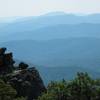
The Signal Knob section of the Massanutten Trail loop.
Jul 7, 2017 near Strasburg, VA
Ascending Signal Knob Peak in the GW National Forest, VA
Aug 31, 2017 near Strasburg, VA
Steep, rocky trail (Tuscarora) heading back to the ridge
Aug 31, 2017 near Strasburg, VA
loading

Weather


Current Trail Conditions

All Clear 38 days ago
Add Your Check-In

Check-Ins

Apr 14, 2023
Mike Banks
Mar 31, 2023
Andrew Davis
10.7mi — 4h 19m
Dec 16, 2021
Will Heinle
Feb 6, 2021
Nora Ellingsen
Jan 10, 2021
Michael Gorkowski
Rocky and steep — 4h 30m
Jul 19, 2020
Zach Gore
10.6mi — 4h 42m
Jun 7, 2020
Emily Comerford
A lot of rock scramble. I would recommend going counter clockwise so that you start with the rock scramble.
May 9, 2020
Shannon P
Great hike - wind was wild and it was chilly so didn't see many animals, but still great hike with great views! 10.6mi — 5h 30m
Welcome

Join the Community

Create your FREE account today!
Already have an account? Login to close this notice.

Get Started