
 Continue with onX Maps
 Continue with Facebook


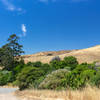
 Particularly Special Place


 Intermediate

 Intermediate
Local Club: Bay Area Ridge Trail Council
Jun 6, 2023: 2023 Ridge Trail Challenge
Jun 6, 2023: Accessible Adventure: Penitencia Creek
Jun 6, 2023: 21st Anniversary East Bay Hills Hike & Ride
 Tilden Park Loop
4.4 mi 7.1 km • 864' Up 263.36 m Up • 864' Down 263.34 m Down
 Kensington, CA
 Wildcat Canyon Loop
9.4 mi 15.2 km • 889' Up 270.83 m Up • 892' Down 272.02 m Down
East Ri…, CA
10k Loop at Briones
6.9 mi 11.1 km • 773' Up 235.71 m Up • 773' Down 235.61 m Down
Orinda, CA
 Hills in Richmond
5.1 mi 8.1 km • 1,054' Up 321.13 m Up • 1,057' Down 322.12 m Down
Richmond, CA
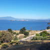
 Miller/Knox Regional Shoreline Kid Friendly Loop
3.0 mi 4.9 km • 68' Up 20.63 m Up • 68' Down 20.7 m Down
Ohlone-Crystyl Ranch Loop
5.5 mi 8.9 km • 734' Up 223.87 m Up • 747' Down 227.67 m Down


0 Comments