
 Continue with onX Maps
 Sign in with Facebook


 Particularly Special Place


 Difficult
Difficult
Difficult
 Difficult
Land Manager: USFS - White Mountain National Forest Office
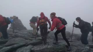
 The Presidential Traverse
19.0 mi 30.5 km • 7,705' Up 2348.41 m Up • 7,131' Down 2173.59 m Down
 Gorham, NH
 Lower Ammonoosuc River Falls Trail
2.4 mi 3.9 km • 102' Up 31.07 m Up • 102' Down 31.04 m Down
 Arethusa Falls Out and Back
2.9 mi 4.7 km • 868' Up 264.68 m Up • 869' Down 264.78 m Down
Diana's Bath Out and Back
1.1 mi 1.8 km • 83' Up 25.41 m Up • 85' Down 25.82 m Down
 North C…, NH
Echo Lake Trail
North C…, NH
Echo Lake Trail
0.9 mi 1.5 km • 94' Up 28.6 m Up • 94' Down 28.78 m Down
North C…, NH
 Bald Mountain/Artists Bluff Loop
1.5 mi 2.4 km • 535' Up 163.11 m Up • 532' Down 162.09 m Down
Franconia, NH


0 Comments