BMT: Segment 1a-1c (Springer Mountain to Three Forks/ FS 58)
Elevation
Ascent:
569'
173 m
Descent: -1,730' -527 m
High: 3,736' 1,139 m
Low: 2,569' 783 m
Grade
Avg Grade: 7% (4°)
Max Grade: 19% (11°)
Weather
Popular hikes nearby
Benton MacKaye Trail
287.2 mi 462.3 km • Point to Point • 53,404 ft Ascent 16277.4 m Ascent
Woody Gap and Dockerty Lake Loop
20.3 mi 32.7 km • Loop • 3,301 ft Ascent 1006.11 m Ascent
Neels Gap - Lake Winfield Scott Traverse
6.2 mi 10.0 km • Point to Point • 1,416 ft Ascent 431.71 m Ascent
Blood Mountain Loop
6.6 mi 10.6 km • Point to Point • 1,424 ft Ascent 434.06 m Ascent
Yonah Mountain Trail #632
4.6 mi 7.4 km • Out and Back • 1,471 ft Ascent 448.34 m Ascent
Raven Cliffs Falls
5.5 mi 8.8 km • Out and Back • 895 ft Ascent 272.91 m Ascent
Navigate on-trail with our free app
“The section of the Benton MacKaye Trail stretching from Springer Mountain to Three Forks/FS 58.”
— Richard Harris
Features
Commonly Backpacked · Views
Section Of
Need to Know
Description
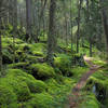
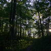
Trail Description: The AT begins at Springer Mountain (WP 8, 3782’) and the BMT begins 0.2 miles up the AT (WP 9, 3750’) a short distance past the trail to the Springer Mountain Shelter. The Benton MacKaye plaque (WP 10) is 0.1 miles down the BMT on the right mounted on a rock slab and it provides another good photo opportunity. The trail goes downhill to the short side trail to Owen’s Overlook at mile 1.3 (WP 11). This is a great lunch spot with views of the surrounding mountains. The BMT crosses FS 42 at mile 1.7 (WP 7), then heads downhill to a dry gully, up over a small ridge, then down to a stream crossing. There is a nice campsite at mile 2.2 just after crossing the stream on the right (WP 12). There are two more creek crossings at mile 2.6 and 2.7. At mile 3.2 the BMT crosses the AT (WP 13) on a ridgeline. The trail then goes downhill to a right-hand turn at mile 3.4, then heads back up over a ridge to again cross the AT at mile 3.9 (WP 14) on Rich Mountain. The Stover Creek AT Shelter is 0.8 miles down the AT west from this intersection. The BMT goes straight across the AT and follows the top of Rich Mountain (3357’) on a fairly level trail for the next mile or so, then heads down the west side of the ridge to its last intersection with the AT at mile 5.9 just south of Three Forks (WP 15). Turn right on the AT and go a short distance to a bridge over the creek and FS 58, where there is parking and camping (WP 16, 2550’). This is mile 6.0.
Campsites: The Springer Mountain AT Shelter (WP 17) has a lean to, water, and a bear cable. There is another campsite is at mile 2.2 just after you cross a small branch (WP 12). The Stover Creek AT Shelter is 0.8 miles west on the AT from the AT/BMT crossing at mile 3.9 with a lean to, water, and a bear cable. Camping is permitted at Three Forks on the south side of the creek before crossing the footbridge (WP 16).
Water Sources: Water is available at the Springer Mountain Shelter (A), at the campsite at mile 2.2 (WP 12, B), at a creek crossing at mile 2.6 (WP 18, B) and again at mile 2.7 (B). Water is available down the AT from the BMT/AT intersection of mile 3.9 west at the Stover Creek Shelter 0.8 miles (A) or east at a creek crossing 0.9 miles (A). Water is available also at Three Forks (WP 16, C).
Hiked this trail?
We need help with the following missing trail information:
Family Friendly, ADA Accessible, Flora & Fauna
Contacts
Local Club: Benton MacKaye Trail Association
Land Manager: USFS - Chattahoochee-Oconee National Forest
Dec 1, 2019: U.S. Forest Service Announces Foothills Landscape Project
0 Comments