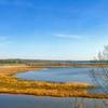
 Jug Bay Tour
6.5 mi 10.5 km • 298' Up 90.69 m Up • 292' Down 89.06 m Down


 Croom, MD
 National Arboretum Figure-Eight
2.0 mi 3.2 km • 209' Up 63.73 m Up • 207' Down 62.98 m Down


 Washington, DC
 Accotink Creek Two Lookouts Loop
2.9 mi 4.7 km • 31' Up 9.59 m Up • 38' Down 11.45 m Down


 Fort Be…, VA
 Rock Creek Park Loop: Western Ridge to Valley Trails
8.8 mi 14.2 km • 484' Up 147.49 m Up • 485' Down 147.73 m Down


 Washington, DC
 Boulder Bridge Loop
3.1 mi 5.0 km • 270' Up 82.22 m Up • 263' Down 80.05 m Down


 Washington, DC
 Rock Creek Valley Loop
1.3 mi 2.1 km • 35' Up 10.78 m Up • 35' Down 10.76 m Down


 Washington, DC


0 Comments