
 Continue with onX Maps
 Continue with Facebook


 Particularly Special Place


 Intermediate
Intermediate
Intermediate
 Intermediate
Land Manager: Alabama State Parks
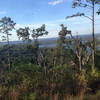
 Lake Guntersville Loop
3.8 mi 6.1 km • 272' Up 82.82 m Up • 270' Down 82.26 m Down

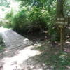
 Hays Preserve Loop
1.9 mi 3.0 km • 20' Up 6.09 m Up • 20' Down 6.17 m Down
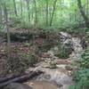
 Big Cove to Duck Weed Basin Loop
4.5 mi 7.3 km • 17' Up 5.05 m Up • 17' Down 5.07 m Down
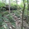
 Jean Shorts Special
4.6 mi 7.5 km • 755' Up 230.21 m Up • 754' Down 229.93 m Down
Owens C…, AL
 North Plateau Loop
1.9 mi 3.0 km • 79' Up 24.16 m Up • 81' Down 24.77 m Down
 High Trail to Hotel Basin
4.4 mi 7.0 km • 738' Up 224.98 m Up • 737' Down 224.78 m Down


0 Comments