Dogs Leashed

Features
Lake · River/Creek · Views · Waterfall
Description
Geraldine Lakes Trail is relatively easy to the first Geraldine Lake and the waterfall at the other end. After this waterfall, the trail becomes difficult due to extensive boulder hopping, difficulty in finding the trail, and rock scrambling/climbing at the waterfall just below the second Geraldine Lake.
To find the Geraldine Lakes Trail, take the Athabasca Falls turnoff from the Icefields Parkway (Hwy 93). Go past Athabasca Falls to Geraldine Road, a dirt road, on the left. Follow Geraldine Road until it ends at a small parking area and trailhead. The trailhead sign clearly points the way to Geraldine Lakes Trail.
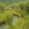
Geraldine Lakes Trail immediately heads into a fir forest with dense undergrowth. The trail climbs gradually for about the first 0.5 miles and then levels off as it approaches the first Geraldine Lake. About a mile from the trailhead, the first Geraldine Lake is reached, a beautiful blue-green lake in a mountain valley. The trail then closely follows this lake's west shore for about 0.5 miles, to the lake's end. The waterfall at the end of the first lake can be seen in the distance.
After passing the first lake, Geraldine Lakes Trail begins to climb steeply along the side of the waterfall at the end of the first lake. There are places here where the trail is not very well marked and it is easy to get off trail, so watch carefully to stay on track.
At the top of the first waterfall, about 1.8 miles from the trailhead, the boulder hopping begins. The trail levels off, but is difficult to follow among the boulders. So, watch for cairns and very short stretches that appear trail-like. Here the trail enters a narrow, scenic valley between two steep mountain sides. The waterfall at the outlet of the second Geraldine Lake, appears in the distance. The trail continues to be all boulder hopping as it goes to this waterfall. Then at this waterfall, one must climb up to the top of this waterfall, somehow.
After climbing to the top of the waterfall at the second Geraldine Lake outlet, the trail levels off and the second Geraldine Lake comes into view. The trail then follows the east side of the second Geraldine Lake, to the end of the lake, where the trail ends.
Beyond the second Geraldine Lake, there is a third and fourth Geraldine Lake, that require route finding skills to visit (and so are not considered to be part of this trail).
Contacts
Shared By:
Joan Pendleton

 Continue with onX Maps
 Continue with Facebook


 Particularly Special Place


 Difficult


0 Comments