Hiking Project Logo

A long out-and-back along the scenic Simpson River that also travels through an open burn area.


Your Rating: Rating Rating Rating Rating Rating      Clear Rating
Your Difficulty:
Your Favorites: Add To-Do · Your List
Zoom in to see details
Map Key

5.4

Miles

8.7

KM

Point to Point

4,513' 1,376 m

High

4,060' 1,238 m

Low

471' 144 m

Up

19' 6 m

Down

2%

Avg Grade (1°)

8%

Max Grade (5°)

Dogs Unknown

Features River/Creek · Views · Wildlife

Family Friendly This trail is fairly flat and offers great views the whole way.

Trails close due to bear activity, so be sure to check before heading out.

Description

The Simpson River parking area is easy to find on the east side of the Banff-Windermere Highway (aka BC 93) about 57 km northeast of Radium Hot Springs and 46 km south of Trans-Canadian Highway. The parking area and bridge offer great views of the Kootenay River and valley for those just looking for a quick, scenic stop. Anyone who ventures farther will be rewarded with excellent views through the open meadow - the result of a forest fire in 2001.

Head across the bridge and through the meadow along the clear trail. The overgrown grasses along the trail mean that your lower half could get extremely wet from early morning dew. However, the Kootenay/Simpson Valley is well worth wet feet as nearly the entire 8.8 km of the trail is a casual stroll with mountain views in every direction. The elevation gain is barely noticeable for most of the way, although there are a few spots made steeper by erosion.

The trail initially heads south along the Kootenay River before turning east to follow the Simpson River. At this point, a tiny bluff offers great views to the south over Simpson River. The trail levels out again and heads southeast. A few muddy areas have "boardwalks" made of felled trees to ease the going. From these, you'll be elevated above the meadow/new growth so take the opportunity to soak in the views and look for wildlife.

A little over a mile and a half into the trip, you'll pass through a small cluster of trees that survived the fire. After that, the trail turns straight east. A few places near the cliff down to the river offer excellent views to the mountains of Assiniboine Provincial Park. Slightly past three miles, the trail crosses a small brook that flows down a boulder field. There is a bridge made of a large tree, but you can probably cross the creek without it.

The last mile and a half of the trail follows closely to Simpson River. The trail "ends" at the border of Assiniboine Provincial Park, but you can continue into the park if you are planning on backpacking and have a permit. Otherwise, you'll have to head back to the parking area.

Contacts

Shared By:

Karl W

Trail Ratings

  3.5 from 2 votes

#25005

Overall
  3.5 from 2 votes
5 Star
0%
4 Star
50%
3 Star
50%
2 Star
0%
1 Star
0%
Trail Rankings

#25,005

Overall
6 Views Last Month
1,911 Since Apr 16, 2017
Easy/Intermediate Easy/Intermediate

50%
0%
50%
0%
0%
0%

Photos

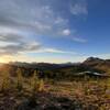
Hike through the open meadow on a wet morning for the full experience.
Apr 16, 2017 near Invermere, BC
Citadel Peak is visible through the open burn area.
Apr 16, 2017 near Invermere, BC
Citadel Peak commands the landscape from a bluff on the Simpson River.
Apr 16, 2017 near Invermere, BC
Crossing the Vermillion River on the Simpson River Trail
Nov 11, 2017 near Invermere, BC

0 Comments

Current Trail Conditions

Unknown
Add Your Check-In

Check-Ins

Sep 10, 2016
Karl W
Welcome

Join the Community! It's FREE

Already have an account? Login to close this notice.