
 Continue with onX Maps
 Sign in with Facebook


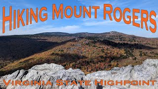
 Particularly Special Place


 Intermediate
Intermediate
Intermediate
 Intermediate
Land Manager: Mount Rogers National Recreation Area
 Grayson Highlands: A.T. – Pine Mtn Loop
12.3 mi 19.8 km • 1,872' Up 570.52 m Up • 1,872' Down 570.63 m Down
 Marion, VA
 Mt. Rogers Out-and-Back
9.7 mi 15.7 km • 1,216' Up 370.51 m Up • 1,214' Down 370.12 m Down
 Virginia Creeper National Recreation Trail
34.7 mi 55.9 km • 1,118' Up 340.8 m Up • 2,599' Down 792.07 m Down
 Jefferson, NC
Alligator Rocks to Bluff Mountain
Jefferson, NC
Alligator Rocks to Bluff Mountain
1.0 mi 1.6 km • 316' Up 96.31 m Up • 316' Down 96.27 m Down
Brumley Mountain Trail - Hayter's Gap to the Great Channels
6.1 mi 9.7 km • 1,133' Up 345.45 m Up • 1,132' Down 344.92 m Down
Lebanon, VA
Stone Mountain Loop Trail
4.4 mi 7.1 km • 884' Up 269.44 m Up • 884' Down 269.37 m Down
Thurmond, NC


0 Comments