Hiking Project Logo

A beautiful canyon trail with a thousand years of fascinating history.


Your Rating: Rating Rating Rating Rating Rating      Clear Rating
Your Difficulty:
Your Favorites: Add To-Do · Your List
Zoom in to see details
Map Key

14.3

Miles

22.9

KM

Point to Point

6,423' 1,958 m

High

5,366' 1,635 m

Low

642' 196 m

Up

1,699' 518 m

Down

3%

Avg Grade (2°)

53%

Max Grade (28°)

Dogs Unknown

Features Fall Colors · Views

Please Respect and Protect archaeological sites: Stay on trail, help prevent damage. Don’t move artifacts, let everyone enjoy the discovery. Stay out of ancient buildings and off walls, they are fragile! Report looting and vandalism: 1 800 722 3998

Description

The full trail is often completed as a three day backpack, looping back via Bullet Canyon Trail.

Starting right out of the ranger station, cross the road and enjoy easy hiking in the desert wash. Pass through tall tunnels of grass until the canyon starts in about a mile. There's an unusual stand of aspen trees here, which would normally require a much higher elevation. But they have survived in this micro-climate as clones of the same tree for 11,000 years!

At 2.0 miles, the canyon opens to a huge bowl and pour-over. The canyon becomes much deeper now with imposing walls on each side. You'll cross the stream many times, but the trail remains easy (though not always easy to find - look for cairns!).

At 4.0 miles, you come to an major side canyon to the right and a huge grove of cottonwoods. Look up to the right on the cliff, and you'll see the Junction Ruins - perched under a huge overhang with excellent natural protection. Below the cliff is the "midden," or trash heap. Yep, this is where they threw the trash from the ruins above. Tons of broken pottery shards litter the ground. Respect the area and do not disturb the remains. There are fun ruins to explore on ground level as well as the higher ones, which you cannot access.

Back on the trail, continue 0.7 miles to the Turkey Pen Ruin, with more houses up high on the cliff. Down below are many houses and a kiva that you can explore. The highlight here is a set of sticks that have stood for nearly 1,000 years and appears to be a pen to hold turkeys. Excellent petroglyphs line the wall.

At 7.2 miles, Todie Canyon comes in on the left. You can potentially escape back to the road by climbing out of this canyon.

After passing a major pour-over that you have to hike around (look for cairns!), you reach Split Level Ruin, which comes into view at 10 miles.

Pass Coyote Canyon at around 13 miles, and look for the incredible pictographs at the Green Mask ruin soon after.

The canyon comes to an end at a junction with another canyon. Most will return the way that they came.

Shared By:

Nick Wilder

Trail Ratings

  4.3 from 4 votes

#4

in Cedar Mesa

#10051

Overall
  4.3 from 4 votes
5 Star
25%
4 Star
75%
3 Star
0%
2 Star
0%
1 Star
0%
Trail Rankings

#4

in Cedar Mesa

#336

in Utah

#10,051

Overall
23 Views Last Month
6,809 Since Oct 6, 2016
Difficult Difficult

0%
0%
25%
0%
75%
0%

Photos

Looking up at the upper, inaccessible Junction Ruins
Oct 5, 2016 near Blanding, UT
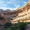
Beautiful canyon leading to Anasazi ruins.
Oct 5, 2016 near Blanding, UT
Cool rock in the wash!
Oct 6, 2016 near Blanding, UT
How did they get to their homes???
Oct 6, 2016 near Blanding, UT
The amazing Turkey Pen is still standing hundreds years later.
Oct 5, 2016 near Blanding, UT
An enormous boulder split in two and left this slot
Oct 6, 2016 near Blanding, UT

0 Comments

Weather


Current Trail Conditions

Unknown
Add Your Check-In

Check-Ins

Join the Community

Create your FREE account today!
Already have an account? Login to close this notice.

Get Started.