
 Continue with onX Maps
 Continue with Facebook


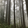
 Particularly Special Place


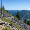
 Intermediate
Intermediate
Intermediate
 Intermediate
Land Manager: WA DNR
 Poo Poo Point via East Sunset Way Trailhead
7.7 mi 12.4 km • 2,110' Up 643.16 m Up • 2,109' Down 642.96 m Down
 Wilderness Peak Loop
3.7 mi 6.0 km • 1,243' Up 378.92 m Up • 1,243' Down 378.87 m Down
 Rattlesnake Ledge
4.3 mi 6.9 km • 1,111' Up 338.7 m Up • 1,110' Down 338.42 m Down
Riverbend, WA
Weeks Falls to Twin Falls
7.3 mi 11.7 km • 1,072' Up 326.66 m Up • 1,067' Down 325.28 m Down
Mason, Island, & Rainbow Lakes
10.5 mi 17.0 km • 2,772' Up 844.85 m Up • 2,771' Down 844.68 m Down
Riverbend, WA
 Thompson Lake via Mt. Defiance
16.1 mi 25.8 km • 5,068' Up 1544.59 m Up • 5,067' Down 1544.42 m Down
Riverbend, WA


0 Comments