Hiking Project Logo

A multiuse (hiking, biking, equestrian) trail following Turkey Creek.


Your Rating: Rating Rating Rating Rating Rating      Clear Rating
Your Difficulty:
Your Favorites: Add To-Do · Your List
Zoom in to see details
Map Key

2.8

Miles

4.4

KM

Point to Point

437' 133 m

High

249' 76 m

Low

162' 50 m

Up

351' 107 m

Down

4%

Avg Grade (2°)

12%

Max Grade (7°)

Dogs Leashed

Features River/Creek · Wildflowers

Description

North Turkey Creek Trail starts by splitting from Graylyn Multiuse Trail just south of the Multiuse Trail parking. Turn left to get on the trail. The trail begins heading down gradually towards Turkey and Sycamore Creeks. Most of the hills are gradual, but a few parts are pretty steep, especially right before and after the bridge over a tributary of Sycamore Creek. Be aware that bicyclists use this trail and they will be going pretty fast heading down the hills. As you head down toward the creek, you can see the Sycamore Trail just below.

After crossing the bridge, the trail heads up and then follows a ridgeline between Sycamore and Turkey Creeks. The trail is roughly parallel to Ebenezer Church Road. The park has constructed walls along portions of the trail to prevent erosion and keep users on the trail. There are good wildflower viewing opportunities here, including beautiful passionflower. In about 2 miles, the trail comes out very close to the road - you can see it and hear traffic at this point. The trail will end roughly at the confluence of Sycamore and Turkey Creeks. At this point, going straight will continue on South Turkey Creek Multiuse Trail and turning left will get on Cedar Ridge Multiuse Trail.

Contacts

Shared By:

Justin Paul

Trail Ratings

  2.7 from 3 votes

#45327

Overall
  2.7 from 3 votes
5 Star
0%
4 Star
0%
3 Star
67%
2 Star
33%
1 Star
0%
Trail Rankings

#1,682

in North Carolina

#45,327

Overall
3 Views Last Month
301 Since Mar 22, 2016
Intermediate Intermediate

0%
0%
100%
0%
0%
0%

Photos

Final leg of South Turkey Creek trail after finishing Turkey Creek / Cedar Ridge loop run.
Nov 22, 2015 near Cary, NC
Beginning of Cedar Ridge Trail from Ebenezer Church Road Bridge gate entrance.
Nov 22, 2015 near Cary, NC
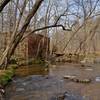
Sycamore Creek crossing on the Cedar Ridge Trail near the Ebenezer Church Road Bridge gate entrance to Umstead State Park. At lower creek flows, the creek can be crossed on stepping stones, and it is about 15 feet wide. When it is this high, it is easier to find a downed tree to cross the creek.
Nov 22, 2015 near Cary, NC

0 Comments

Weather


Current Trail Conditions

Bad / Closed 48 days ago
Add Your Check-In

Check-Ins

Apr 16, 2017
Justin Isberg
Welcome

Join the Community! It's FREE

Already have an account? Login to close this notice.