Hiking Project Logo

Score some great views from this ledge-skimming loop trail.


Your Rating: Rating Rating Rating Rating Rating      Clear Rating
Your Difficulty:
Your Favorites: Add To-Do · Your List
Zoom in to see details
Map Key

2.5

Miles

4.1

KM

Point to Point

1,761' 537 m

High

935' 285 m

Low

858' 262 m

Up

807' 246 m

Down

12%

Avg Grade (7°)

32%

Max Grade (18°)

Dogs Unknown

Features Fall Colors · River/Creek · Views

Description

Located just 6 miles west of the Saco Ranger Station. Turn right off the Kancamagus Scenic Byway through the Covered Bridge. The parking lot is on the right and the trailhead is opposite the parking lot.

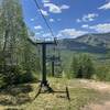
This trail features a gradual climb with some steep pitches thrown in for good measure. Be sure to stop at the top and enjoy the excellent views! You'll be able to see Mt. Chocorua and the Swift River Valley from the top.

In the fall of 2016, the area experienced a wildfire which consumed roughly 400 acres and took 3 days to contain and extinguish. Since the fire, the USFS and members of the local fire department came in to do maintenance to the trail to clean it up and make it safe for hikers again. In the process, new areas of trail were cut to navigate around newly formed hazards from the fire. These revisions to the trail are permanent and new trail markers have been added.

Contacts

Shared By:

Tom Robson

Trail Ratings

  4.3 from 11 votes

#2

in Spruce Hill

#7494

Overall
  4.3 from 11 votes
5 Star
45%
4 Star
45%
3 Star
0%
2 Star
9%
1 Star
0%
Trail Rankings

#2

in Spruce Hill

#157

in New Hampshire

#7,494

Overall
4 Views Last Month
2,705 Since Oct 22, 2015
Intermediate Intermediate

0%
0%
64%
36%
0%
0%

Photos

The view of Mt. Chocoura.
Aug 19, 2017 near Bartlett, NH
Three Sisters plus South Moat Mountain.
Aug 19, 2017 near Bartlett, NH
A second viewpoint located along Boulder Loop
Aug 19, 2017 near Bartlett, NH

0 Comments

Weather


Current Trail Conditions

Unknown
Add Your Check-In

Check-Ins

Jul 31, 2023
Lindsay Welch
The switchbacks added after the fires have lengthened the trail, though much of the extra mile was due to traversing the steep declines with zig zags. 3.8mi — 2h 32m
Jan 22, 2023
Stacy Parr
5mi
Oct 19, 2022
Art Pun
6.2mi — 2h 46m
Aug 20, 2022
Christopher Petty
2.5mi — 1h 15m
Jul 17, 2021
Jen Beams
New loop made the rear portion 1.8 miles and the front part 1.2. Almost exactly 3 miles total round trip
Apr 29, 2021
Maya Pellegrino
Feb 6, 2021
NH Hiker95
A quick but very entertaining loop with a little bit of everything. Features fine views of the Kancamagus area.
Sep 15, 2020
W F
Welcome

Join the Community

Create your FREE account today!
Already have an account? Login to close this notice.

Get Started