Hiking Project Logo

A gradual trail with great views of the Logan River and the Second and Third Dams.


Your Rating: Rating Rating Rating Rating Rating      Clear Rating
Your Difficulty:
Your Favorites: Add To-Do · Your List
Zoom in to see details
Map Key

7.4

Miles

11.9

KM

Out and Back

5,078' 1,548 m

High

4,746' 1,447 m

Low

561' 171 m

Up

561' 171 m

Down

3%

Avg Grade (2°)

17%

Max Grade (10°)

Dogs Leashed

Features Birding · Fall Colors · Lake · River/Creek · Swimming · Views · Wildflowers · Wildlife

On 9/29/19 the second half of the trail was closed and a detour was put in place. On the detour we could see there was construction near the trail going on.

Hiking to the detour is ~2.5 miles the Bridger Look-off Trail is ~0.8 mile and will connect you to the beginning of the Mill Hollow Trail. Continue on that for ~0.4 miles to connect back with the Logan River Trail.

Overview

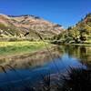
This route follows the Logan River pretty closely and allows for spectacular views of cliffs on both sides of the river, as well as some amazing forest canopies, and two beautiful reservoirs.

There are definitely a lot of users on this trail including mountain bikers, runners, and walkers.

Description

Starting from the parking lot either by the gate or across the road, you can start up the trail that leads to the Stokes Nature center, pass by it and continue past other gates and continue on past the weir station (in the river bed) and then past Second Dam and some more gates.

The trail narrows to singletrack after Second Dam, but is still very distinct and continues all the way up to the Bridger Campground where it widens again to a road. Just follow it through the campground and then continue on the other side until you get to Third Dam and the parking lot there.

There are no difficulties except some switchbacks after Second Dam that really aren't that difficult, but just steeper than the rest of the very gradual climbing that occurs on the road-like trail that composes most of the rest of the hike.

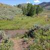
This is a great trail for a rainy day as most of the trail has a bit of gravel to keep things from getting too muddy.

Contacts

Shared By:

Tomsen Reed with improvements by Kath Thom and 1 other

Trail Ratings

  4.1 from 10 votes

#3

in Logan

#3151

Overall
  4.1 from 10 votes
5 Star
30%
4 Star
50%
3 Star
20%
2 Star
0%
1 Star
0%
Recommended Route Rankings

#3

in Logan

#197

in Utah

#3,151

Overall
10 Views Last Month
4,376 Since Jul 21, 2015
Easy Easy

100%
0%
0%
0%
0%
0%

Photos

Aerial view of the last section of the trail as it passes third dam (taken from the Crimson Trail, another trail nearby)
Jul 21, 2015 near North L…, UT
A view of Third Dam and the some cliffs of Logan Canyon.
Oct 18, 2015 near North L…, UT
The trail winding west around Third Dam.
Oct 18, 2015 near North L…, UT
The trail heading toward Spring Hollow from Third Dam.
Oct 18, 2015 near North L…, UT

0 Comments

Weather


Current Trail Conditions

Unknown
Add Your Check-In

Check-Ins

Aug 1, 2021
Tyler W
5.5mi — 2h 00m
May 16, 2020
Branden Hurst
Jul 7, 2019
Shelly Fryer
Nice day to do it. Not sure if it was 7.4 with the construction detour. 7.4mi
Jun 2, 2019
Hannah Stamp
4mi
Oct 8, 2017
merlinblack
7.6mi
Jun 4, 2017
Carla Orellana
Aug 28, 2016
Izaak Wierman
Welcome

Join the Community! It's FREE

Already have an account? Login to close this notice.