
 Continue with onX Maps
 Sign in with Facebook


 Particularly Special Place


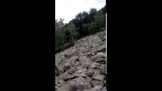
Vitosha Nature Park
 BG
BG- …Sofia-Grad Province
- Sofia
- Vitosha Nature Park


Trails in Vitosha Nature Park - 37
Hiking Project is built by hikers like you. Add Your Trails
5.0
mi
8.1
km
#1Cherni Vrah - Zlatine Mostove
 Intermediate/Difficult
Sofia, BG

|
Intermediate/Difficult
|
Sofia, BG |
4
|
|
2.2
mi
3.6
km
#2Dragalevtsi - Bai Kristo
 Difficult
Sofia, BG
|
Difficult
|
Sofia, BG |
2
|
|
8.7
mi
14.0
km
#3Yarlovo - Brezite
 Intermediate
Sapareva Banya, BG
|
Intermediate
|
Sapareva Banya, BG |
1
|
|
|
2.8
mi
4.5
km
#4Boyana - Hizha Momina Skala
Difficult
Sofia, BG

|
Difficult
|
Sofia, BG |
6
|
|
5.5
mi
8.9
km
#5Celo Zheleznitsa - Cherni Vrah
 Very Difficult
Sofia, BG
|
Very Difficult
|
Sofia, BG |
2
|
|
|
1.0
mi
1.7
km
#6Boyan Petrov Trail: Knyazhevo - Kopitoto
Very Difficult
Sofia, BG
|
Very Difficult
|
Sofia, BG |
3
|
|
|
2.8
mi
4.6
km
#7Goli Vrah - Cherni Vrah
Intermediate/Difficult
Sofia, BG
|
Intermediate/Difficult
|
Sofia, BG |
4
|
|
1.2
mi
1.9
km
#8Zlatine Mostove - Hizha Momina Skala
 Easy
Easy
Sofia, BG
|
Easy
|
Sofia, BG |
2
|
|
|
1.5
mi
2.4
km
#9Boyana-Belata Voda Connection
Easy
Sofia, BG
|
Easy
|
Sofia, BG |
2
|
|
|
2.9
mi
4.7
km
#10Dragalevtsi - Boyana
Intermediate
Sofia, BG
|
Intermediate
|
Sofia, BG |
1
|
Photos of Vitosha Nature Park - 11
Hiking Project is built by hikers like you. Add Your Photos


Vitosha Nature Park Hiking
- 107 Miles 172 Kilometers of Trail
- 1 Recommended Route
- 5
Easy Trails

- 19
Intermediate Trails

- 14
Difficult Trails

Hiking Project is built by hikers like you. Share
what you know about this area!
Weather Averages
|
High
|
Low
|
Precip
|
Days w/
|
| J | F | M | A | M | J | J | A | S | O | N | D |

