Continue with onX Maps
 Sign in with Facebook


 Particularly Special Place


Cleveland National Forest
 CA
CA- Southern California
- Cleveland National Forest


Recommended Routes in Cleveland National Forest - 3
Hiking Project is built by hikers like you. Add Your Recommended Routes


Cleveland National Forest Hiking
- 102 Miles 164 Kilometers of Trail
- 3 Recommended Routes
- 7
Easy Trails

- 26
Intermediate Trails

- 7
Difficult Trails

Hiking Project is built by hikers like you. Share
what you know about this area!
Weather Averages
|
High
|
Low
|
Precip
|
Days w/
|
| J | F | M | A | M | J | J | A | S | O | N | D |
Trails in Cleveland National Forest - 37
Hiking Project is built by hikers like you. Add Your Trails
3.6
mi
5.8
km
#1Wrangler #901
 Intermediate
Pine Valley, CA

|
Intermediate
|
Pine Valley, CA |
1
|
|
3.4
mi
5.5
km
#2Espinosa Trail
 Difficult
Descanso, CA

|
Difficult
|
Descanso, CA |
4
|
|
|
2.2
mi
3.5
km
#3Observatory Trail #1E02
Intermediate
Aguanga, CA
|
Intermediate
|
Aguanga, CA |
2
|
|
1.9
mi
3.1
km
#4Corte Madera Peak
 Intermediate/Difficult
Pine Valley, CA
|
Intermediate/Difficult
|
Pine Valley, CA |
2
|
|
|
0.2
mi
0.4
km
#5Lawson Peak Trail
Intermediate/Difficult
Jamul, CA
|
Intermediate/Difficult
|
Jamul, CA |
5
|
|
|
2.1
mi
3.3
km
#6Oak Grove Trail
Intermediate/Difficult
Aguanga, CA
|
Intermediate/Difficult
|
Aguanga, CA |
2
|
|
|
4.6
mi
7.4
km
#7Espinosa Trail #4E03
Intermediate
Pine Valley, CA
|
Intermediate
|
Pine Valley, CA |
1
|
|
|
5.6
mi
9.0
km
#8Kernan #802
Intermediate
Pine Valley, CA
|
Intermediate
|
Pine Valley, CA |
1
|
|
|
2.2
mi
3.5
km
#9Espinosa Equestrian Trail
Intermediate
Descanso, CA
|
Intermediate
|
Descanso, CA |
1
|
|
|
14.3
mi
23.1
km
#10Secret Canyon Trail #4E01
Difficult
Descanso, CA
|
Difficult
|
Descanso, CA |
7
|
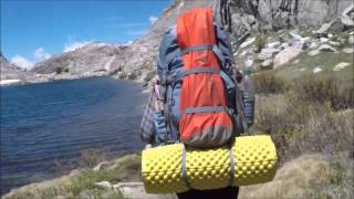
Photos of Cleveland National Forest - 69
Hiking Project is built by hikers like you. Add Your Photos