
 Continue with onX Maps
 Continue with Facebook


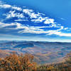
 Particularly Special Place


 Easy/Intermediate

 Easy/Intermediate
Land Manager: Bald Mountain Creek Nature Preserve
 Bald Mountain Creek Preserve Outer Loop
7.3 mi 11.8 km • 1,875' Up 571.35 m Up • 1,878' Down 572.36 m Down
 Mount Mitchell
11.7 mi 18.8 km • 3,651' Up 1112.72 m Up • 3,650' Down 1112.62 m Down
 Black M…, NC
 Carvers Gap to Grassy Ridge Bald
4.7 mi 7.5 km • 986' Up 300.52 m Up • 985' Down 300.25 m Down
Roan Mo…, TN
Laurel Falls Out and Back from Dennis Cove
2.3 mi 3.7 km • 408' Up 124.38 m Up • 408' Down 124.25 m Down
Coon Den Falls and Appalachian Trail Loop
3.6 mi 5.8 km • 1,008' Up 307.14 m Up • 1,004' Down 305.94 m Down
Hampton, TN
Rough Creek Goodness
7.0 mi 11.3 km • 1,343' Up 409.25 m Up • 1,341' Down 408.61 m Down


0 Comments