
 Continue with onX Maps
 Continue with Facebook


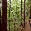
 Particularly Special Place


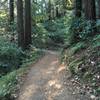
 Easy
Easy
Easy
Easy
 Easy
Easy
Land Manager: California State Parks - Monterey District
 Engineer Canyon to Station One Rd.
4.2 mi 6.7 km • 436' Up 132.89 m Up • 432' Down 131.56 m Down

 Airplane Canyon
11.3 mi 18.2 km • 1,854' Up 565.1 m Up • 1,854' Down 565.1 m Down
Toro Park Easy Loop
5.6 mi 9.0 km • 876' Up 266.87 m Up • 876' Down 267.04 m Down
Snively's Ridge Out-and-Back
5.8 mi 9.4 km • 1,500' Up 457.33 m Up • 1,497' Down 456.4 m Down
Merry-Go-Round to Sprig Trail Loop
8.8 mi 14.2 km • 1,676' Up 510.98 m Up • 1,678' Down 511.54 m Down
 Gilroy, CA
Merry-Go-Round Loop
Gilroy, CA
Merry-Go-Round Loop
4.1 mi 6.6 km • 826' Up 251.67 m Up • 826' Down 251.7 m Down
Gilroy, CA


0 Comments