
 Continue with onX Maps
 Continue with Facebook


 Particularly Special Place


 Intermediate/Difficult
Intermediate/Difficult
Intermediate/Difficult
 Intermediate/Difficult
Land Manager: City of Poway - Community Services - Parks & Recreation
 Los Peñasquitos Creek Waterfall
3.7 mi 6.0 km • 68' Up 20.72 m Up • 68' Down 20.76 m Down

 Palacio Del Mar Views Loop
2.6 mi 4.2 km • 248' Up 75.53 m Up • 247' Down 75.25 m Down
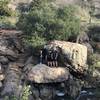
 Potato Chip Rock
7.1 mi 11.5 km • 1,881' Up 573.36 m Up • 1,881' Down 573.34 m Down
 Poway, CA
Coast to Crest Trail - North Shore Lake Hodges
Poway, CA
Coast to Crest Trail - North Shore Lake Hodges
15.6 mi 25.1 km • 407' Up 124.16 m Up • 407' Down 124.16 m Down
Torrey Pines State Reserve Loop
2.4 mi 3.9 km • 329' Up 100.18 m Up • 330' Down 100.46 m Down
Del Mar, CA
 Encinitas Ranch Golf Course Route
1.3 mi 2.0 km • 59' Up 18.1 m Up • 50' Down 15.36 m Down


1 Comment