
 Continue with onX Maps
 Continue with Facebook


 Particularly Special Place


 Intermediate

 Intermediate
Land Manager: USFS - Sequoia National Forest Office
 Trail of 100 Giants
1.3 mi 2.1 km • 130' Up 39.48 m Up • 130' Down 39.49 m Down
 Alta Si…, CA
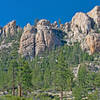
 The Needles Lookout
9.9 mi 16.0 km • 1,659' Up 505.69 m Up • 1,659' Down 505.67 m Down
Alta Si…, CA
Whiskey Flat Out-and-Back
12.4 mi 19.9 km • 903' Up 275.35 m Up • 903' Down 275.32 m Down
Kernville, CA
 Heart of the Domelands
28.3 mi 45.6 km • 3,737' Up 1139.09 m Up • 3,763' Down 1146.98 m Down
Mineral King Loop
25.6 mi 41.3 km • 9,101' Up 2773.89 m Up • 9,091' Down 2771.03 m Down
Three R…, CA
 Eastern Sierra Tour
66.9 mi 107.6 km • 8,476' Up 2583.59 m Up • 8,477' Down 2583.64 m Down
Lone Pine, CA


0 Comments