Dogs Off-leash

Features
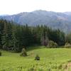
Views · Waterfall

The trail is on Rogue River-Siskiyou National Forest land and is open year-round. During the winter, there may be enough snow in the canyon to make finding and following the trail difficult.
Need to Know
The informal trailhead for the falls is about 3.5 miles west of the blinking light in Selma, Oregon (on Highway 199) on the Illinois River Road (Forest Road 4103). There is a small turnout on the road's south side at an unsigned junction with Forest Road 011 (Star Flat Road). Park so that you do not block this road. A much larger pull-out can be found a little farther along the road to the west. The hike starts on the north side of Forest Road 4103, past a wooden log restoration fence.
Description
Snailback Falls, when conditions are wet, cascade down a steep rocky ravine in the Illinois Valley just west of Selma, Oregon. It's not much to look at in the depths of summer but during and after winter storms the falls cascade some 400 feet and can be seen from quite a distance.
The route follows an old mining road for 0.9 miles as it climbs about 950 feet to the top of the ridge between Snailback Creek and Baldwin Gulch. The old road ends at the top of the ridge, where an obvious and well-built use trail begins contouring in to the canyon holding Snailback Creek. At 0.3 miles from the top of the ridge, you'll reach the remains of the old forgotten copper mine. Here the obvious use trail swings around the diggings to the left (west) to a deep trench (prospect) in the side of the slope.
From this trench, a narrower and less obvious use trail continues back and down into the canyon for 0.3 miles to the base of the lower falls. Along the way, there is one spot where you can look up and see the upper falls shooting into the canyon some 400 feet above you. The trail ends here at the base but you can - if you're careful - scramble farther up along the creek to see more the various cascades that comprise these falls.
This area was partially burned by a wildfire in 2018 and this has weakened some of the trees and loosened some of the rocks and soil. So be extra careful of your footing if you leave the use trail to explore the falls.
Flora & Fauna
Expect ticks along the trail in late spring through summer and poison oak all year round.
Contacts
Shared By:
BK Hope
with improvements
by Carl Tollestrup

 Continue with onX Maps
 Continue with Facebook


 Particularly Special Place


 Intermediate/Difficult


0 Comments