
 Continue with onX Maps
 Continue with Facebook


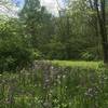
 Particularly Special Place


 Easy/Intermediate
Easy/Intermediate
Easy/Intermediate
 Easy/Intermediate
Land Manager: Central Ohio Metro Parks
 A.W. Marion State Park Loop
5.2 mi 8.3 km • 370' Up 112.72 m Up • 363' Down 110.76 m Down


 Blacklick Woods Metro Park
4.0 mi 6.4 km • 76' Up 23.04 m Up • 75' Down 23.01 m Down
 Scioto Loop
3.3 mi 5.2 km • 52' Up 15.72 m Up • 52' Down 15.77 m Down
Scioto Audubon Metro Park
2.4 mi 3.9 km • 58' Up 17.63 m Up • 56' Down 17 m Down
 Logan Trail North Loop
9.8 mi 15.7 km • 1,476' Up 449.91 m Up • 1,490' Down 454.19 m Down
Kingston, OH
Prairie Oaks Loop
5.1 mi 8.3 km • 110' Up 33.62 m Up • 110' Down 33.61 m Down


 All Clear


0 Comments