
 Continue with onX Maps
 Continue with Facebook


 Particularly Special Place


 Difficult
Difficult
Difficult
 Difficult
Land Manager: Whistler Blackcomb
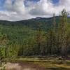
 Jane Lake Loop
12.5 mi 20.0 km • 2,251' Up 686.04 m Up • 2,251' Down 686 m Down
 Train Wreck
1.4 mi 2.2 km • 178' Up 54.26 m Up • 178' Down 54.24 m Down
 Into the Mystic and Lord of the Squirrels Loop
15.4 mi 24.8 km • 4,203' Up 1281.11 m Up • 4,202' Down 1280.7 m Down
Whistler, BC
Panorama Ridge from Cheakamus Lake
19.5 mi 31.4 km • 4,700' Up 1432.42 m Up • 4,700' Down 1432.43 m Down
 Whistler, BC
Garibaldi Lake
Whistler, BC
Garibaldi Lake
11.4 mi 18.3 km • 3,444' Up 1049.85 m Up • 3,444' Down 1049.61 m Down
Whistler, BC
Mamquam Lake and the Gargoyles
29.0 mi 46.7 km • 7,074' Up 2156.03 m Up • 7,073' Down 2155.81 m Down
Squamish, BC


0 Comments