
 Continue with onX Maps
 Continue with Facebook


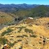
 Particularly Special Place


 Difficult


 Difficult
Local Club: Arizona Trail Association
Apr 9, 2024: This Might Be The Hardest (And Best) Hike In Arizona
Apr 6, 2024: A Cross In The Barbed Wire: Reflections On Faith & Immigration
Apr 5, 2024: Increased Immigrant Traffic Near U.S./Mexico Border
Land Manager: USFS - Tonto National Forest Office
 Palo Verde Trail
8.4 mi 13.5 km • 251' Up 76.62 m Up • 252' Down 76.72 m Down
 Mazatzal Peak Loop
15.1 mi 24.4 km • 2,868' Up 874.13 m Up • 2,841' Down 865.98 m Down
 Skunk Tank - Cave Creek Loop
10.5 mi 16.8 km • 1,661' Up 506.17 m Up • 1,661' Down 506.16 m Down
Carefree, AZ
 Granite Mountain Loop
6.3 mi 10.2 km • 447' Up 136.18 m Up • 446' Down 136.09 m Down
Tom's Thumb from Gateway
12.6 mi 20.2 km • 2,591' Up 789.85 m Up • 2,588' Down 788.82 m Down
See Canyon Horton Springs Loop
14.4 mi 23.2 km • 2,962' Up 902.8 m Up • 2,962' Down 902.74 m Down
Star Va…, AZ


0 Comments