
 Continue with onX Maps
 Continue with Facebook


 Particularly Special Place


 Very Difficult

 Very Difficult
Land Manager: USFS - Tonto National Forest Office
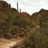
 Bulldog Canyon Saddle and Pass Mountain Trail Loop
5.0 mi 8.1 km • 1,090' Up 332.29 m Up • 1,090' Down 332.24 m Down
 Apache…, AZ
 Maricopa Trail - Pass Mountain Connector
9.4 mi 15.1 km • 538' Up 163.95 m Up • 1,335' Down 406.81 m Down
 Water Ranch Middle Route
1.3 mi 2.1 km • 20' Up 6.1 m Up • 20' Down 6.16 m Down
Gilbert, AZ
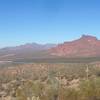
 Miners Needle Loop
9.3 mi 14.9 km • 1,297' Up 395.23 m Up • 1,301' Down 396.42 m Down
Gold Camp, AZ
Lizard/Cactus Over-the-Rock Loop
2.0 mi 3.3 km • 109' Up 33.35 m Up • 111' Down 33.86 m Down
Camelback Mountain via Cholla Trail
3.2 mi 5.2 km • 1,193' Up 363.49 m Up • 1,190' Down 362.66 m Down
Paradis…, AZ


 Minor Issues


0 Comments