
 Continue with onX Maps
 Continue with Facebook


 Particularly Special Place


 Intermediate
Intermediate
Intermediate
 Intermediate
Land Manager: US Fish and Wildlife - San Diego National Wildlife
 Hollenbeck Canyon Loop
13.2 mi 21.2 km • 1,519' Up 462.98 m Up • 1,522' Down 463.95 m Down


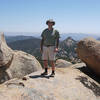
 Three Peak Out-and-Back
5.8 mi 9.4 km • 1,772' Up 540.24 m Up • 1,772' Down 540.18 m Down
Mission Trails Loops
11.1 mi 17.9 km • 1,593' Up 485.66 m Up • 1,581' Down 482.01 m Down
La Mesa, CA
Fortunas Loop CCW from Tierrasanta
6.9 mi 11.1 km • 1,369' Up 417.33 m Up • 1,369' Down 417.3 m Down
 Lawson and Gaskill Peaks
7.0 mi 11.2 km • 2,109' Up 642.74 m Up • 2,109' Down 642.71 m Down
 Penasquitos Creek Loop
13.1 mi 21.1 km • 319' Up 97.13 m Up • 319' Down 97.18 m Down


0 Comments